Paddling the Columbus Scioto Mile

Paddling the Downtown Columbus Scioto Mile Route

Don’t just call it a facelift. The revitalization of the downtown Columbus riverfront runs much deeper. The dramatic upgrade of the past several years began with the 2015 removal of dams that returned the Scioto River to its more natural state. The creation of beautifully landscaped parks along the river was the next step, followed by the renovation of the Center of Science and Industry (COSI) museum, the construction of the National Veteran Memorial and Museum, and the rebirth and ongoing development of the Franklinton Peninsula on the west banks of the Scioto. The area has become a bonafide destination.

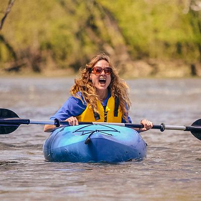
There’s no better way to take in the sights of the so-called Scioto Mile than a leisurely paddle along the Scioto River. It’s the Columbus equivalent of a boat ride on the Seine in Paris, past Notre Dame and the Louvre. Sort of.

The downtown stretch of the Scioto is one of the river’s widest sections in the city proper. Lowhead dams to the north and south of this section prevent commercial traffic, and a gentle (to nearly nonexistent) current makes for stress-free, pleasant upriver paddling. The Scioto also rarely freezes over, so if you’re hale and hearty with the right cold-weather gear, it's possible to paddle year-round on this mellow and scenic section that cuts through the heart of Columbus.

Launch Spots

There are three nice access points downtown. Starting upriver from the north, they’re located: above the Broad Street Bridge, on the river-left, east side; above the Main Street Bridge, also on the river-left, east side; and just above the railroad bridge, on the river-right, west side. Be forewarned: It can be challenging to transport your kayak from your vehicle to these three launches. You have to park a couple hundred yards away, and carry your craft across a street or two and down some grassy knolls to the river.

The best place to launch is about a mile to the south at the Lower Scioto Park, just off West Whittier Street and near the Scioto Audubon Park. There’s a large parking lot, which includes extra-large spots for vehicles with trailers, and you can back your car right up to the concrete ramp that leads down into the river. 

Route

Start at the Lower Scioto Park and head north, upriver (there’s a lowhead dam that prevents you from traveling downriver). Note that a peninsula protects much of the water when launching from the Audubon Boat Ramp, so make sure to go around its end and into the main current (if you stick to the riverbank, you’ll dead-end in a couple hundred yards in a backwater bay).

Forests line both sides of the river as you head north, and then as you pass under the Interstate 70 bridge, the view opens on the river-right, west side to all the development sprouting up in Franklinton. After paddling under the railroad bridge, downtown emerges ahead, as does the Scioto Mile: a network of multi-use trails that connect eight different parks and connect 175 protected greenway acres along both riverbanks. Landmarks punctuate the parkland corridor: COSI and the National Veteran Memorial and Museum to the west; Bicentennial Park, and its fountains, plus the skyline of downtown Columbus, to the east.

Look for the glimmering, white façade of LeVeque Tower, which was completed in 1927. It was one of the tallest buildings in the nation at the time, and it stands 555 feet and 5 inches tall—the “extra” 5 inches so that it could claim a taller height than the 555-foot Washington Monument.

Just upriver of the Broad Street Bridge, the river bends to west, and the North Bank Park Pavilion is on river-left, north side, with the Arena District beyond. The distance from Lower Scioto Park upriver to the Broad Street Bridge is about a 1.5-mile trek. You can turn around here, or go another mile, to the confluence of the Scioto and Olentangy rivers, and then head back—and downriver.

Run or Walk

If you’re not in the mood to paddle, or don’t have a kayak, canoe or standup paddleboard (yet), the 2.5-mile route from the Lower Scioto Park, or nearby Scioto Audubon Park (where there’s also free parking), to the confluence of the two rivers makes for a great 5-mile run, or walk.

Where To Park

You can’t go wrong at the Lower Scioto Park, where the parking is free. If you park downtown, the east side of the river offers more options (meters and parking garages) that are closer to the river and two of the three launch spots. More info:  sciotomile.comexperiencecolumbus.com

Refuel

For a meal with a view, drop in on Milestone 229. It's on the river-left, east bank of the Scioto, steps away from the Scioto Mile Fountain. You can dine inside the glass-enclosed dining room and gaze out upon the river while you enjoy shrimp and grits or pizza.

All articles are for general informational purposes.  Each individual’s needs, preferences, goals and abilities may vary.  Be sure to obtain all appropriate training, expert supervision and/or medical advice before engaging in strenuous or potentially hazardous activity.

MORE STORIES