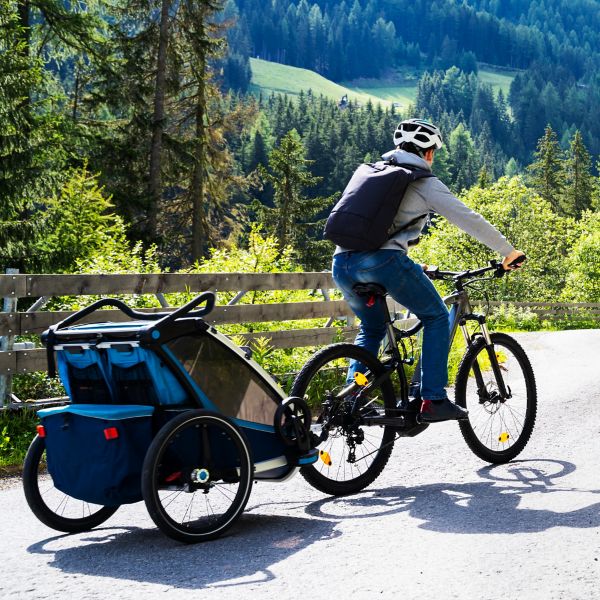
How To Choose the Best Bike Trailer
Adapt your steed for toting gear, groceries, kiddos, and more.
The Great Allegheny Passage (GAP) stretches 150 miles from the Golden Triangle in downtown Pittsburgh to Cumberland, Maryland. The scenery, history, and smooth riding make it an amazing adventure from end to end (it was the first path inducted into the Rail-Trail Hall of Fame).
In Cumberland the GAP meets the C&O Towpath, which continues another 185 miles to Washington D.C., creating a 335-mile route that ambitious cyclists can do in a week or so. But the GAP is also a great route for a weekend trip, and is ideal for anyone looking to give bikepacking a try. There are a number of free campsites within a day’s riding distance of Pittsburgh, and they’re right on the path for easy access and logistics.
GAP trail access can be found in a number of places along Pittsburgh’s Three Rivers Heritage Trail, which blankets the banks of all three rivers around the city’s center and act as tributaries for the trail. Check with local bike advocacy group Bike Pittsburgh for specific route planning from your home if you live in the city itself.
If you can’t ride to the GAP, there are good options for overnight parking. The commercial parking structures on Sidney Street in the city’s South Side, near Hot Metal Bridge, offer secure parking for less than $20 a day. Another good option: the Waterfront shopping complex in Homestead, where there’s a GAP parking lot between TGIfriday’s and UNO pizzeria.
Free campgrounds along the GAP, located within relatively easy reach of the city, make it simple and affordable to try bikepacking. The Hiker/Biker campsites offer large open spaces for tents, Adirondack-style shelters, pit or composting toilets, and (in most cases) potable water from April 15 to October 31. Taps and maintenance are often suspended for the winter, so check if you’re going during the colder months.
The campgrounds outlined here are situated 27 to 60 miles from Pittsburgh, offering options for riders of varying levels, and also the option to camp more than one night. No reservations are taken for these sites; they’re all free and first-come, first-served.
This expansive site sits along the Youghiogheny River, next to the historic Dravo Cemetery (established in 1812). The camping area has two Adirondack shelters (first-come, first-served) and room for up to 30 tents. Visitors will find picnic tables, potable water, a pair of composting toilets, several fire rings, and free firewood provided by the Mon/Yough Trail Council. Bonus: The site has a large pavilion that provides shelter from sun or rain.
Find it: Heading east, the campground is easily spotted on the left hand side of the trail; just watch for the cemetery immediately preceding it.
Located at the far end of Cedar Creek Park, along the Youghiogheny River, this campground has it all: two Adirondack shelters (first-come, first-served), plenty of room for tents, potable water, bathroom facilities, fire rings, and picnic tables.
Want to start a trip here? Cedar Creek also offers overnight parking. Just register your vehicle at the parking kiosk, and be aware that the park gates close at dusk so any car left will be locked in for the night.
Find it: You’ll pass through the bulk of the park, including a boat launch and several pavilions, before arriving at the campground on the left hand side, when travelling east.
This is the spot to really get away—or at least feel like it. Roundbottom Campground is more secluded than the other sites on this list, so it feels more remote even though it’s right on the path. Three first-come, first-served Adirondack shelters (two six-person and one solo) and room for 100 tents offer plenty of choices. There are picnic tables and fire rings, but only non-potable water, so plan accordingly by either filling up prior to arriving or packing a water treatment system.
Find it: Nestled into a bend in the Youghiogheny River, Roundbottom lies directly on the trail (to the left for eastbound riders).
Located just outside Yough Creek Park and Connelsville proper, this site feels more urban than the others. It also has some unique sights, like the Connellsville Gateway Arch, which straddles the path and features colorful, locally made glass, and a restored caboose that was built for the Baltimore and Ohio Railroad. You’ll also find the requisite Adirondack shelters (four) and lots of open space for tents. Composting toilets, picnic tables, and potable water are available, but no open fires are allowed here.
Find it: The site lies on the right side of the path for eastbound users. If you reach the downhill descent into Yough Creek Park, you’ve gone too far.
South Side: Check out the bicycle-themed Over The Bar (OTB) Cafe on Carson Street. Try the Dirt Rag Delight in either Beef, Turkey, Chicken or Veggie. Peanut butter never tasted so good.
Homestead: The Waterfront shopping complex offers just about anything you could want in the form of food and beverage, but don’t miss the Fudge Farm (and be prepared to add a few extra miles to your outing to compensate).
Sutersville: Need some quick fuel? Yough Twister offers soft serve, hotdogs, and ice cream treats. For more traditional pub fare, try Driscoll & Sons Cafe (both on the right if heading eastbound).
West Newton: The Trailside Pub is an institution worth experiencing (try the Irish Egg Rolls). It’s located on the right for eastbound riders, immediately after the Main St. crossing. The West Newton Bike Shop is directly below the Trailside Pub, if you need parts, service, or advice.
Find more info at Great Allegheny Passage. Whether you’re going for a weekend or a week, it’s worth picking up the GAP TrailGuide ($10). It’s updated yearly with maps, mileage charts, interesting factoids, and food and lodging recommendations, and even includes a large fold-out map.
All articles are for general informational purposes. Each individual’s needs, preferences, goals and abilities may vary. Be sure to obtain all appropriate training, expert supervision and/or medical advice before engaging in strenuous or potentially hazardous activity.