5 Things To Do in Allegheny Land Trust Green Spaces

Photo: Brett Rothmeyer

Finding new land to protect, especially anywhere in the eastern U.S., is no easy task.

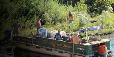
Centuries of development coupled with high population density mean there are few unprotected tracts left for conservation organizations to step in and save. But in the Pittsburgh region, at least, the Allegheny Land Trust is finding them—protecting more than 3,300 acres of green space throughout 32 municipalities in southwestern Pennsylvania. The nonprofit has a knack for spotting ecologically sensitive lands, often purchasing the land outright to steward it themselves (with the help of more than 700 volunteers). The other big benefit: ALT’s efforts to keep that land accessible for recreation, where visitors can find hiking, biking, horseback riding, birding, fishing, hunting and more. So whether you’re a Pittsburgh local, or just visiting, you’ll be missing out by not exploring lands thankfully conserved by ALT. 

1. Camp on Sycamore Island

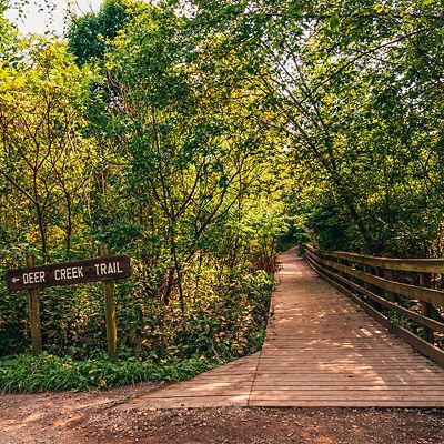
Sycamore Island, east of Pittsburgh in the middle of the Allegheny River, feels like an urban oasis. Accessible only by boat, the island quickly cuts visitors off from the bustling city nearby. A lush canopy covers loop trails and a web of hiking options. And if you can pack your overnight gear in a canoe or kayak (it’s an easy 2.4-mile paddle from Allegheny RiverTrail Park), you can also camp out on the island (fill out and submit a permit to the ALT) or picnic at the table near the middle of the island. Spend a day hunting for mushrooms and birding before you fall asleep just upstream of one of Pennsylvania’s bustling metro areas. 

2. Bike the Audubon Greenway 

This 161-acre plot offers quintessential Pennsylvania landscape: towering old-growth oak trees, a babbling creek and rolling green hills. A 1.6-mile loop trail (start where it meets Audubon Road) crisscrosses the Greenway through meadows and woods, and is a popular bike ride or hike—a local hunting club even uses the Greenway for traditional fox hunts, on horseback with hounds. For hikers, a number of unmaintained trails weave away from the loop, connecting the Greenway to other ALT-conserved lands. 

3. Explore Ruins at Dead Man’s Hollow

What is today a web of trails through dense forests marked by waterfalls, creeks, and scenic overlooks was once the site of a 19th-century quarry and an early 20th-century pipe factory. Both littered Dead Man’s Hollow with coal-fired kilns, railroad track, and clear-cut storage yards, as well as tales of murder and death. A mysterious hanging, a shootout between a robber and local shopkeeper, and an explosion that killed at least two quarry workers: The fables from Dead Man’s Hollow come to life amid the industrial remnants and fragments of former kilns throughout the park. Check out ruins right at a trailhead on the Youghiogheny River, then follow the wooded “Dead Man’s Run” trail up the ravine to a multitude of other trails. 

4. Spot Wildflowers at the Linbrook Woodlands

If you time it right, exploring the miles of trail above Big Sewickley Creek can yield some spectacular flora. Mixed into eastern hemlock and oak forests, keep your eyes peeled for red trillium (most prolific in May), lesser periwinkle (April), and the bold yellow petals of trout lily (April). Alongside those flowers, there’s plenty of red-tailed hawks, white-tailed deer, and wild turkey running around Linbrook. And on the western end of the park, a deteriorating cemetery and the foundation of an old church, built in 1864, offer a glimpse back at the woodlands’ prior settlers (though much of this land was originally inhabited by the Shawnee people).  

5. Take to the Water at Wingfield Pines

Wingfield Pines is one of the best examples of how the ALT can transform a piece of protected land. A strip mine in the 1940s and then a golf course, ALT purchased the land in 2001 and immediately got to work designing a passive treatment system for the abandoned mine drainage leaking through the side. The gravity-fed system treats 1,500 to 2,000 gallons of iron-rich water every minute, cleaning it before it empties into Chartiers Creek. It was designed specifically for visitors to walk through and explore, seeing the water go from murly orange to clean and clear in real-time. Walk the boardwalk through the marshes or hop in a kayak or canoe to explore Wingfield Pines from the mellow creek (there’s a boat launch in the park). 

All articles are for general informational purposes.  Each individual’s needs, preferences, goals and abilities may vary.  Be sure to obtain all appropriate training, expert supervision and/or medical advice before engaging in strenuous or potentially hazardous activity.

MORE STORIES