The Top 4 Undammed Rivers to Paddle

Put the following world-class stretches on your bucket list.

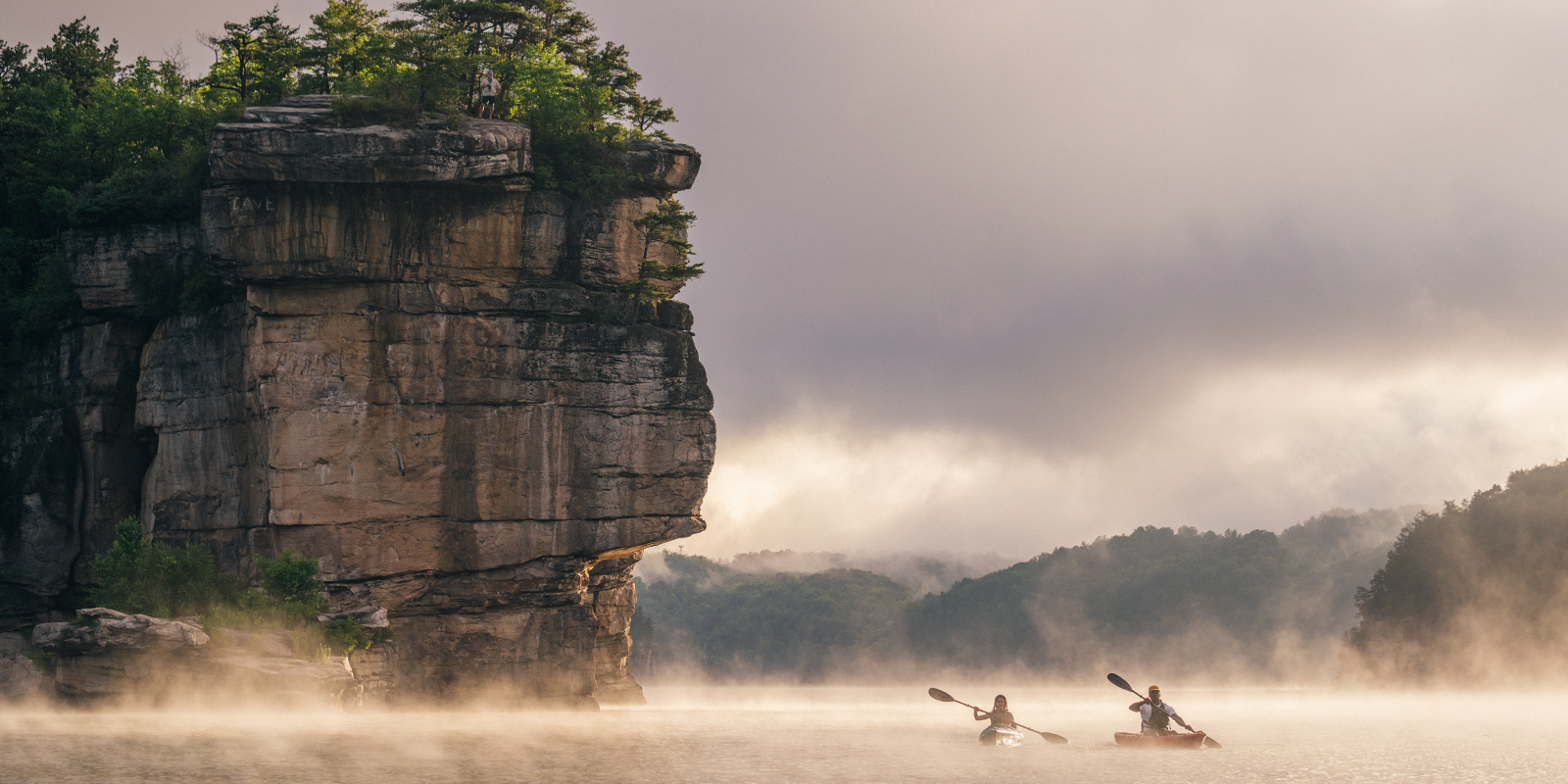
There’s a new era in ecological restoration across the country with the removal of dams restoring rivers to their natural, free-flowing states and enhancing everything from fish migration to recreation. According to conservation group American Rivers, in the past 20 years, more than 1,100 dams have been removed in the U.S.—many of them aging, unsafe structures that outlived their usefulness. In 2020, 69 dams were removed across 23 states (led by Ohio with 11); and last year an additional 57 dams were removed, reconnecting more than 2,290 miles of rivers in 22 states, with Pennsylvania leading the charge at seven. At least 25 more are slated for removal this year.  

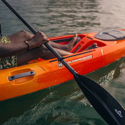
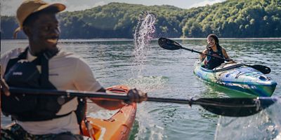
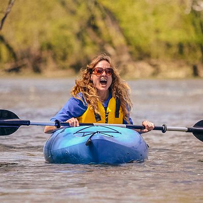
There’s good reason for the decommissioning efforts. Removing dams benefits river and aquatic health, and public safety—not to mention climate resilience. It’s better for fish migration, riparian zones and, believe it or not, even hydropower production through better energy-efficiency practices. More good news: It’s also better for paddlers, with reservoirs and concrete impediments replaced by clear-flowing waterways for recreation. Want to paddle some of these recently restored, free-flowing waterways? Put the following world-class stretches on your bucket list.  

Penobscot River, Maine 

New England’s second largest river system, Maine’s Penobscot (including its West and South branches) flows 264 miles from Penobscot Lake on the Maine/Quebec border into Penobscot Bay and the Atlantic Ocean near the town of Bucksport. In 2004, the Penobscot River Restoration Trust led a public-private effort to maintain hydropower production while also restoring the river’s sea-run fisheries. It removed the Great Works Dam in 2012, the Veazie Dam in 2013, and created a bypass channel around the Howland Dam in 2016. The result: Atlantic salmon and other sea-run fish now have access to 2,000 miles of spawning habitat and populations of striped bass, alewife, blueback herring, smallmouth bass, American eel, rainbow smelt, tomcod and endangered shortnose sturgeon are booming. The removals are also better for paddlers, who can now recreate in the river’s lower section, following the wake of Henry David Thoreau, without the hazards. 

Local Beta: One such stretch, revealing ripples and channels buried since the Industrial Revolution, is the section around the town of Old Town, home to canoe maker Old Town Canoe as well as the Penobscot Nation. Numerous access points allow you to paddle various lengths, with Class I-II waves replacing the now-gone dam. One flatwater fave: the 60-mile Medway-to-Old Town stretch, offering great smallmouth bass fishing (access via State Route 157 between Medway and Mattawamkeag, or south of Mattawamkeag via U.S. Route 2). Farther upriver, try the East Branch, from Matagamon Lake to Whetstone; or the Upper West Branch from Roll Dam to Chesuncook Village (portage or run the ledge drops at Roll Dam), with views of Mount Katahdin. For whitewater, try the West Branch, from Ripogenus Gorge to Pockwockamus Falls, for some of Maine’s best Class IV-V rapids, including Cribworks, which conservation nonprofit American Whitewater calls “the toughest regularly run rapid in New England.” 

Embrey Dam - Rappahannock River, Fredericksburg, VA 

With the 22-foot-high Embrey Dam on Virginia’s Rappahannock River near Fredericksburg removed in 2004, canoeists, rec kayakers, and standup paddleboarders can now run a half-mile of new Class I-II rapids just north of town. Now the longest free-flowing river in the eastern U.S. and Chesapeake Bay watershed, ‘the Rapp’ extends unblocked for 195 miles, from its origin at Chester Gap in the Shenandoah National Park of western Virginia to Stingray Point in the Chesapeake Bay. Paddlers can now float unimpeded from the upper Rapp to its Chesapeake mouth or enjoy multiple access points for shorter day-trips. The dam’s removal has also transformed the river’s ecology, letting migratory fish like American shad and striped bass gain access to spawning grounds in the upper Rapp and its tributaries for the first time in over 150 years. 

Local Beta: For the Fredericksburg run, put in at the boat launch on State Route 618 (River Road) near Motts Run Park, which also serves as the takeout for the milder canoe run that starts 24 miles upstream at Kelly's Ford (skip a mile of flatwater by putting in farther down River Road where the road turns away from the river). Several Class I-II rapids occur in the first mile and as you pass under Interstate 95, you enter the former-flatwater section that now has large boulders to navigate. The first new Class II rapid is called Hunters Mill Rapid, where water used to be diverted for a mill downstream near the dam, followed by Carter Never Saw It, a tribute to the late local canoeing icon Randy Carter, who never had a chance to see this stretch. The dam removal also exposed a bus-sized jumping rock known affectionately as “BFR” (“Big Fat Rock”). Novices can take out just below the removed dam on river-right, while more advanced paddlers can navigate Class III Falmouth Rapids just below (hint: stay with the main flow of the river), taking out on river-right at Old Mill Park, just off of Fall Hill Avenue in Fredericksburg. A water trail is also being developed along the river by the Friends of the Rappahannock in cooperation with the Virginia Dept. of Conservation and Recreation, encompassing historical paddling trips from Kelly's Ford to the Fredericksburg City Docks. 

Elwha/Glines Canyon Dams - Elwha River, WA 

For most of the 20th century, a significant portion of Washington’s Elwha River flowed between two reservoirs. Then, in 2011, construction crews began the largest dam removal project in U.S. history on the 108-foot-tall Elwha Dam and the upper 210-foot-tall Glines Canyon Dam. Completed in 2014, the project opened the entire 45 miles of the Elwha River, much of it in Olympic National Park, free-flowing for the first time since 1911. With the two hydroelectric dams barriers to fish populations, as well as paddlers, The New York Times called it, “one of the most promising and pure acts of environmental restoration the region and nation have ever seen.” Now the river runs free from the wilderness backcountry of the Grand Canyon of the Elwha all the way to the Juan De Fuca Strait near Port Angeles, Wash.  

Local Beta: Of note to boaters, the lower Elwha Dam covered an area that dropped 38 feet per mile, which is now open to paddling for a 7-mile run into the ocean. The put-in is just downstream (river-right) of the U.S. 101 bridge at Mile 239.5. Get ready for a river that’s re-awakening: The first section is still developing its new river channel through the leftover sediment of the historic Aldwell Reservoir; use caution as wood hazards, including tree stumps from when the forest was cleared for the dam, are still shifting (scout from the old reservoir boat launch). After a short canyon you’ll approach the Elwha Canyon that was once blocked by Elwha Dam. Its main rapid is at the dam site, Class IV+ That Dam Rapid (portage left, or scout right and beware leftover scrap metal). Just downstream the river flows through a scenic Class II gorge and flatwater. After passing under the State Route 112 bridge, the river migrates back and forth across the floodplain until you reach the new Elwha Road Bridge. (Hint: Hike the Olympic Discovery Trail if you have more time.) A more braided section (stay alert for wood) leads to ocean surf and a new beach forming at the mouth. 

Condit Dam - White Salmon River, WA 

Built in 1903, this 125-foot-high wall came down in 2012, opening up the lower White Salmon to the more than 40,000 paddlers who use the upper section of the waterway. It was the second-tallest dam to be removed in the country, and a true milestone for paddlers (not to mention a demolition that was a visual feast to witness). “At the time, the removal of Condit was the first major dam removal on a river as popular as the White Salmon,” says Thomas O’Keefe, American Whitewater’s Pacific Northwest Stewardship Director. 

Local Beta: The new Class III+ section (with one Class V, Steelhead Falls) drops 44 feet per mile and runs 5 miles down to the Columbia River. Called the White Salmon Narrows (or Bottom), it’s known for its beautiful tight-walled gorge and stunning scenery. After putting in at Northwestern Park, at Mile 1.6 you’ll reach a narrow and surreal passage through the former dam site. A mile later comes river-wide Steelhead Falls (scout and portage on river-left). From here you’ll enter the Narrows, the former Condit Powerhouse on the left and Class III Powerhouse Rapid just below. A mile of flatwater leads you to the Columbia River and your takeout on river-left. Want more? Tack on the 4.3-mile, Class III-IV Middle White section just upstream, which runs from BZ Corner to Husum Falls.

The Next Great Dam-free River to Run - Klamath River, CA 

Another notable river will soon be undammed and flowing free. Starting in 2023, four dams on California’s Klamath River are slated for removal in the largest dam removal project in history. With various sections of the waterway already popular among paddlers, the work will free up 234 river miles from near its source all the way to the Pacific Ocean, enhancing fish runs, riparian zones and additional paddling opportunities. 

In 2020, the Karuk and Yurok tribes, California Gov. Gavin Newsom, Oregon Gov. Kate Brown, the Klamath River Renewal Corporation and PacifiCorp (a subsidiary of Warren Buffett’s holding company Berkshire Hathaway), announced a project calling for the removal of its four dams after years of effort. Once removed, the dams will open up new paddling and fish-migration possibilities in 44 miles of the 234-mile-long waterway that stretches from the Cascades to the Pacific, creating classic new sections of water for river-runners alongside such existing sections as Class III-IV Ward’s Canyon. “When the dams come out,” says Northwest paddler Bill Cross, “boaters will be able to explore a host of new day-trips and string together outstanding multi-day journeys. The restored Upper Klamath will be one of the West’s great whitewater rivers.” 

Perhaps no one is more excited than professional SUP paddler Spencer Lacy, who, last summer, led a team down the river’s entire 234 miles, dams and all, to chronicle the river in its current state before returning once they’re all removed. “We wanted to make an environmental statement,” says Lacy. “One day not too far off we’ll be able to come back after the dams are gone and see the river corridor as it begins to return to its natural state. We can’t wait—it will be great to enjoy the same stretch in its newfound, free-flowing glory.”

All articles are for general informational purposes.  Each individual’s needs, preferences, goals and abilities may vary.  Be sure to obtain all appropriate training, expert supervision and/or medical advice before engaging in strenuous or potentially hazardous activity.

MORE STORIES