How To Experience Golden Gate National Recreation Area

From San Mateo County south of San Francisco, to Marin County north of the Golden Gate Bridge, this huge gem of an urban park is ripe with recreational activities.

It was 1972 when President Nixon signed a bill titled, “An Act to Establish the Golden Gate National Recreation Area,” and today’s Bay Area residents (plus millions of visitors) are better for it. The result is a unique, non-continuous park system that sprawls over 80,000 acres across 37 different park sites on both sides of (and within) San Francisco. Together, they preserve over 1,000 historical sites plus diverse landscapes from Muir Woods National Monument to Alcatraz Island. Active outdoor adventurers, from birders and mountain bikers to backpackers and trail runners, enjoy more than 250 trails over 140 miles of what is now a rich collage of dynamic lands and sites managed by the National Park Service (NPS).

Quick History

Once historic farmland dating back to the 1800s, the U.S. Army assumed national-defense control of much of the land from San Francisco’s Presidio (now the NPS site on the south side of the Golden Gate Bridge) to what’s now known as the Marin Headlands (on the north side) where they established various forts. With the end of World War II, the Army began selling off the land, risking it getting subsumed in the rapid urban expansion that marked the booming post-war years—much to the chagrin of local activist groups who wanted to keep the areas undeveloped.

In 1956, the NPS launched an initiative called Mission 66, which aimed to expand the national park system by the year 1966, highlighting the imperiled status of the Golden Gate National Recreation Area (GGNRA). When activist group Indians of All Tribes led an occupation of Alcatraz Island, the 19-month protest effort (from 1968 to ’69) drew international attention to Native Americans’ rights and their treaty-bound claim to out-of-used federal land (following the penitentiary’s closure in 1963), which ultimately resulted in the fed’s 1970 transfer of the island to the Dept. of the Interior and NPS—and influenced future activism aimed at the redesignation of traditional Indigenous lands.

Today, Alcatraz, with its ferry-ride access to the middle of the San Francisco Bay and its tours of the famous prison, is one historic site of many among the GGNRA. Other sites include remnants of military activity that make up 1,200 historic structures. But the majority of this national recreation area—the largest urban national park in the country, and one of the most-visited units in the NPS system—consists of trails cutting across beautiful open spaces, many of them coastal, spanning 19 different eco-systems.

How To Enjoy the GGNRA

Orient yourself to the park’s three main areas:

  • Marin County—north of San Francisco and the Golden Gate Bridge
  •  San Francisco County—south of the Golden Gate Bridge and within the city of San Francisco
  • San Mateo County—south of San Francisco.

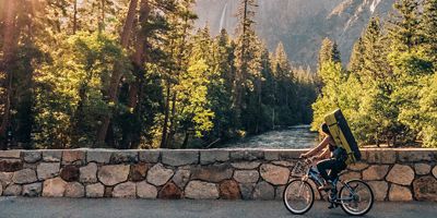
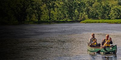
 Access is plentiful for anyone in the Bay Area, with outdoor activities for city dwellers to escape, explore, and revive among nature. Those living in San Francisco proper can ride or run the 1.7 miles across the Golden Gate Bridge (there’s a pedestrian walkway on the east side of the bridge, with bikes allowed on the east and west pedestrian/cycling lanes) to the Marin Headlands and beyond with trails connecting to the expansive Mount Tamalpais Watershed network. Within San Francisco, eucalyptus tree-covered paths in the Presidio provide a trail-running oasis amid a concrete jungle, while Crissy Field provides beachfront beauty. In San Mateo County, coastal and inland trails give the tech industry-saturated area a natural balance. Regardless of which area you’re visiting, there’s more than a few ways to enjoy the GGNRA. More info: nps.gov

Camping/Backpacking

There are four campgrounds in the Golden Gate National Recreation Area located on the north side of the Golden Gate Bridge in Marin County. Available by reservation, all act as great home bases for hiking, mountain biking and other recreational activities in the area. More info: nps.gov

Car Camping: Bicentennial Campground

This small campsite (three tent spots) sits in a cypress grove in the Marin Headlands on Point Bonita overlooking the Pacific Ocean. The campground offers great views of San Francisco across the bay, and is 100 feet from Battery Wallace, an abandoned military site built in 1917 and manned during WWII. The campground requires a 100-foot hike downhill from the parking area.

Car Camping: Kirby Cove

If you’re lucky enough to nab one of the five tent sites at Kirby Cove, you’ll be rewarded with what will feel like your own private beach. This campground sits on the edge of the Marin Headlands atop the Pacific Ocean with a short hike down to secluded Kirby Beach. The campground, which is accessible by vehicle, offers outstanding views of the Golden Gate Bridge and San Francisco. 

Backpacking: Hawk Campground

This campground requires a steep 2.5-mile hike in from Tennessee Valley, or a 3.5-mile hike in from the Miwok Trailhead. Three tent sites sit among pine and cypress trees, with coastal scrub and rolling hills surrounding. It’s a secluded spot without cell coverage, and offers access to multiple trails in the Marin Headlands.

Backpacking: Haypress Campground

Five single-tent campsites and one group site (up to 20 people) is just a 0.7-mile hike up from the Tennessee Valley Trailhead. The Haypress campground is on the northern side of the valley, while the Hawk campground is on the south. The beach at Tennessee Valley is just a couple miles away.

Hiking/Trail Running

With 2,400 species of plants and animals, plus terrain ranging from open grassland to densely wooded, moss-covered redwoods, the GGNRA offers a vast assortment of amazing trails for hiking and trail running. Target the following highlights.

Muir Woods National Monument, Marin County

Giant old-growth coastal redwoods tower in this spectacular forested area. Trails wind on the valley floor and up to connect with a wide array of running/hiking loop options.

Tennessee Valley, Marin County

In the heart of the Marin headlands is this gentle, wide dirt path that leads down to Tennessee Cove Beach, and the Coastal Trail connects Muir Beach and Rodeo Valley Beach to this trail. Hawk and Haypress campgrounds are both accessible from the trailhead.

Presidio, San Francisco

Cypress and eucalyptus trees offer a wooded respite surrounded by the concrete jungle of San Francisco on two sides, and then bound by the San Francisco Bay and the Pacific Ocean on the others.

Pulgas Ridge, San Mateo County

Rolling hills, scrub oak, wildflowers and numerous trails throughout 366 acres of open space preserve make this a popular hiking and trail running spot. It’s dog-friendly, too.

Mori Point, San Mateo County

Trails wind throughout the 100 acres of this newly designated portion of the GGNRA—some hug the coastal cliff of this point that juts out into the Pacific, just south of the city of Pacifica.

Mountain Biking

Stunning singletrack awaits.

Marin Headlands, Marin County

Unlike most national parks, this national recreation area allows mountain biking in some areas. The best and most popular is north of San Francisco in the Marin Headlands. City dwellers can ride across the Golden Gate Bridge and take a left to climb paved Conzelman Road before connecting to the dirt of the Rodeo Valley Trail, the Bobcat, Miwok, Old Springs and Tennessee Valley trails, for starters. The routes in the headlands consist of smooth to rutty fire roads, scrub oak-lined singletrack, and hills…lots of hills. The trails here connect to the Mount Tamalpais Watershed trails. Together the terrain creates variety that any mountain biker could ride for days.   

All articles are for general informational purposes.  Each individual’s needs, preferences, goals and abilities may vary.  Be sure to obtain all appropriate training, expert supervision and/or medical advice before engaging in strenuous or potentially hazardous activity.

MORE STORIES